ArcGIS
ArcGIS : Reviews, Pricing, Features & AlternativesArcGIS is a Geographic Information System (GIS) tool (free trial available). Review ArcGIS : Overview & Pricing
ArcGIS Overview : Features, Pricing, Reviews & Alternatives
ArcGIS is a Geographic Information System (GIS) tool intended for businesses. Let’s discover user reviews, features and prices of this business app.
ArcGIS is listed as a Geographic Information System (GIS) and Development & API for companies and is used for CMMS, Facility Management, Tool Management, Public Works …
ArcGIS prices are available on demand (free trial available).
GIS software to create maps, spatial analysis and share smart visualizations.
Mapping and analysis system to visualize data by location
What is ArcGIS ?
Esri’s ArcGIS is an integrated collection of geographic information system (GIS) software products for multiple platforms and promises standards-compliant management of spatial analysis, data management, and location-based 3D data mapping. By providing the contextual tools for mapping and spatial reasoning, ArcGIS enables users to visualize and analyze data from organizational business practices in terms of environmental location, while collaborating with others by sharing information not only through maps, but also through apps and apps. reports. ArcGIS Online is specifically the hosted online SaaS version of the product, offering a complete cloud-based mapping solution.
ArcGIS brings together maps, apps, data, and people to make smarter decisions and enable innovation within your organization or community. It is a practical way of linking science to action and is used by governments, industry, NGOs and Fortune 500 companies around the world.
The Universal Geographic Information System
This video is an introduction to Esri’s newest application called ArcGIS Pro. Highlights include multiple layouts, viewing and editing 2D and 3D data at the same time, and the new ribbon interface. ranging from logistical support to global cartographic analysis. Build 3D smart cities in minutes with the groundbreaking CityEngine 2016: ESRI’s CityEngine is one of the most advanced 3D modeling suites designed specifically for developing urban landscapes. It uses procedural modeling to generate brilliant 3D city models with loads of… Read more
CityEngine is advanced 3D modeling software for creating massive, interactive and immersive urban environments in less time than traditional modeling techniques. 30-day free trial.
What is ArcGIS? ArcGIS, the powerful mapping and analytics solution, is designed to help users explore, analyze, and share relevant location information. It is full of contextual tools used in spatial reasoning. This, above all, includes mapping educators, developers, industries, and government agencies from around the world. The program uses a powerful Geographic Information System (GIS) to help users solve problems. This suite of tools is quite unique as it contains features such as data collection and management, 3D GIS, remote sensing and imaging, spatial analysis, mapping and visualization. Users use these powerful tools to analyze location-sensitive decisions. It helps decision makers visualize the context of the entities, locations, and processes their business is connected to.
Integrated collection of GIS software products; ArcGIS offers unique functionality and flexible licensing to apply location-based analytics to your business practices. Gain better insights by using contextual tools to visualize and analyze your data. Collaborate and share through maps, apps, dashboards, and reports.
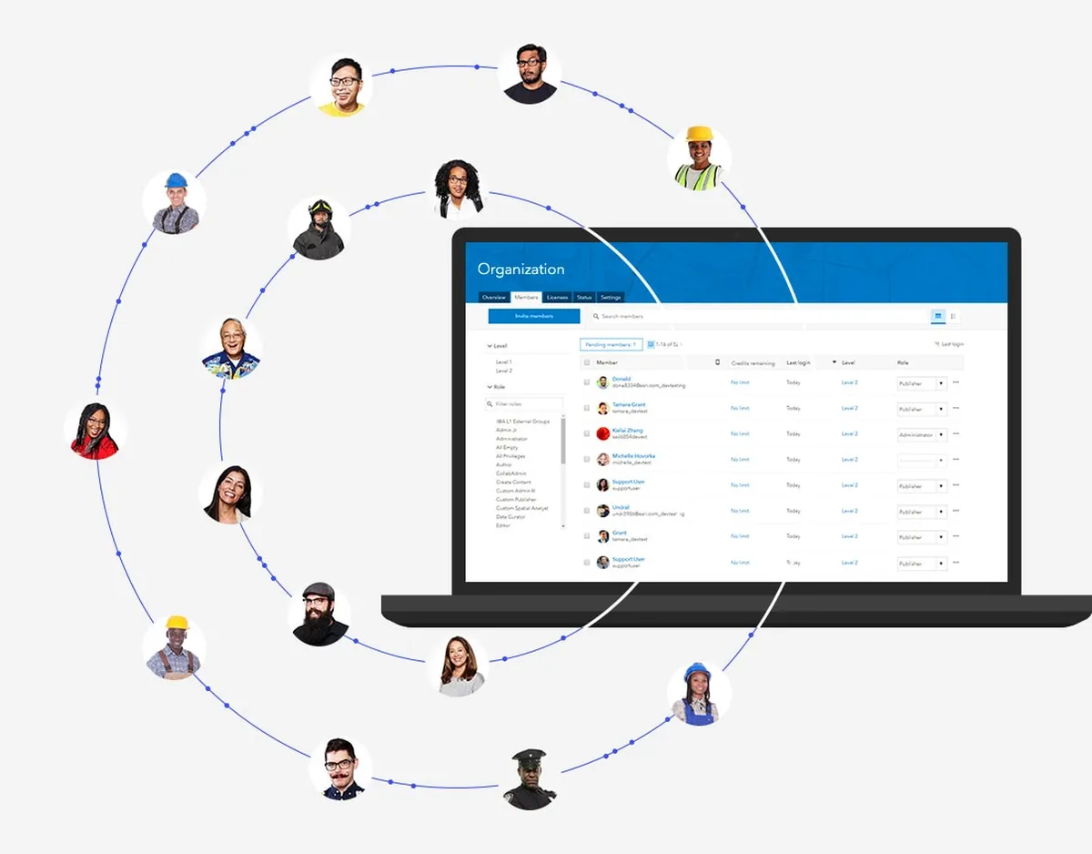
ArcGIS Review : Pros & Cons
Pros & Cons
When it comes to finding the right Geographic Information System (GIS) tools to manage your business, you have too many options – and they all come with their strengths and weaknesses.
One such familiar name in this arena is ArcGIS, and as you may have guessed from the title, this review will tell you more about ArcGIS’s pros and cons.
Weighing the pros & cons is essential before selecting this tool for your business and your team.
ArcGIS Pros : Key Benefits
– ArcGIS Online is the cloud-based SaaS version of ArcGIS, which represents a collaborative online mapping and analysis solution that is accessible anywhere, anytime, secure, and compliant with FedRAMP, FISMA, and TRUSTe accreditations.
– Map creation becomes as simple as dragging and dropping a spreadsheet, uploading local data files, or connecting content stored in the cloud, before intelligent mapping generates suggestions for plotting data-driven visualizations while providing custom styling options .
– Enterprise-ready tools include single sign-on (SSO) access, group-based people management, privilege and license assignment, and monitoring of internal activity metrics within an organization and those of publicly shared maps/applications.
– ArcGIS Apps offers an additional collection of integrated location-based apps for field access, with ArcGIS Companion providing native remote access to an ArcGIS Online organization via iPhone and Android devices.
– A collection of basemaps is available in vector format for high-resolution fidelity and flexible styling, including satellite imagery, road maps, landscapes, oceans, and more.
ArcGIS Cons
– Con : Custom integrations can come at a price.
ArcGIS Features
Here is the list of the main features of this computer software :
– 3D Imaging
– API
– Access Controls/Permissions
– Activity Dashboard
– Activity Tracking
– Ad hoc Analysis
– Ad hoc Query
– Ad hoc Reporting
– Alerts / Escalation
– Alerts/Notifications
– Asset Lifecycle Management
– Asset Tracking
– Behavioral Analytics
– Benchmarking
– Bus Mileage Optimization
– Census Data Integration
– Charting
– Chatbot
– Check-in/Check-out
– Collaboration Tools
Main function & Pro Features
– 3D Imaging
– API
– Access Controls/Permissions
– Activity Dashboard
– Activity Tracking
– Ad hoc Analysis
– Ad hoc Query
– Ad hoc Reporting
– Alerts / Escalation
– Alerts/Notifications
– Asset Lifecycle Management
– Asset Tracking
– Behavioral Analytics
– Benchmarking
– Bus Mileage Optimization
– Census Data Integration
– Charting
– Chatbot
– Check-in/Check-out
– Collaboration Tools
ArcGIS Integrations
ArcGIS integrates with more than 25 applications & plugins like Scribble Maps, PermitTrax and AHT TMS (…) : database connection, synchronize data, share files (…) to improve your workflow and increase your productivity !
It also provides a powerful API toolkit that allows developers to build web services and exchange data.
Top 20 ArcGIS integrations
– Procore
– Amilia
– Concept3D
– MAPublisher
– Ultimo Enterprise Asset Management
– Cartegraph
– Flowfinity
– Envisio
– Asset Infinity
– DocStar ECM
– BOSS811
– ArborNote
– DisasterLAN
– Jawg Maps
– Evolve
– WebEOC
– Aurigo Masterworks Cloud
– CitizenServe
– Pandell LandWorks
– Pandell GIS
ArcGIS Pricing
The ArcGIS pricing plan is available on request, but this price is likely to change because different options are offered by the developer : number of licenses, additional functions, add-ons, bundles …
ArcGIS offers several pricing plans :
– Standard : Price on demand
– Start : Price on demand
– Professional : Price on demand
– Enterprise : Price on demand
– Premium : Price on demand
| Standard | Start | Professional | Enterprise | Premium |
| Price on demand | Price on demand | Price on demand | Price on demand | Price on demand |
| Per month | Per month | Per month | Per month | Per month |
| Per user | Per user | Per user | Per user | Per user |
Save $$$ on SaaS and on-premise Software Subscriptions to help your create, grow and scale your business : annual billing usually is cheaper than monthly billing and you can expect 10% to 20% discount.
Sign up for a trial and start using it right away !
Free trials usually are time limited or feature limited but this is a good way to ensure it is the right option for your business before making a purchase.
Screenshot of the Vendor Pricing Page :

Software Pricing Plans
Pricing Details
Pricing Model : Subscription
Free trial : Yes : 14 days
Free plan : No information
Freemium : No information
Starting price : Prices can vary depending on your business needs.
Entry-level set up fee : No setup fee
The pricing details were last updated this year from the vendor website or retrieved from publicly accessible pricing materials and may be different from actual. Please confirm pricing and deals with the vendor website before purchasing.
Deployment & Setup
ArcGIS is a cloud-based Geographic Information System (GIS) platform : its infrastructure is hosted in the United States (probably on AWS, Microsoft Azure or Google Cloud Platform).
arcgis is a SaaS (Software as a Service) / web application : a web browser on a computer is required for full functionality of features and manage dashboard.
It supports desktop operating systems (like Windows and Mac OS …) and mobile platforms (like Android and iOS).
Technical Details & Specifications
Deployment : Cloud / SaaS
Desktop Operating Systems : Windows / Mac OS / Linux …
Mobile Platforms : Android / iOS – iPhone – iPad
Native Apps / Mobile Applications : –
GDPR compliance : No information
Supported languages
This application software supports the following languages : English, German, Arabic, Chinese, Spanish, French, Italian, Japanese, Portuguese, Russian …
Support & Training
Any problem with this computer program ? The vendor offers the following customer service & support to help teams get the most out of their business application : 24/7 Live support, Chat, Email / Help Desk, FAQs / Forum, Knowledge Base, Phone Support, Online Support …
Hotline : Yes
Training options : Documentation, In Person, Live Online, Videos, Webinars …
Industry & Customers
Who use ArcGIS ?
This software package is tailored to business needs : Small and Medium companies, Medium companies (Turnover : – $50 million) in countries like Canada …
This web-based application is recommended for trades : Creative, IT …
This cloud software is used in the sectors : Software, Government administration, Higher Education …
Customer References
Testimonials & Customer References to decide if this is the right business software or service for your company : Terracycle Inc, Techuk, National Audubon Society, Colas Limited, Insight Performance, Polco, Propeterra …
Awards & Recognitions
No information .
Screenshots
This computer program has an ergonomic, intuitive and customizable user interface, which will improve team productivity and collaborative work within your company (Non Profit, Public Administration, Freelancer …)
ArcGIS Screenshots & Images : UI, dashboard …

ArcGIS Business Software Pricing
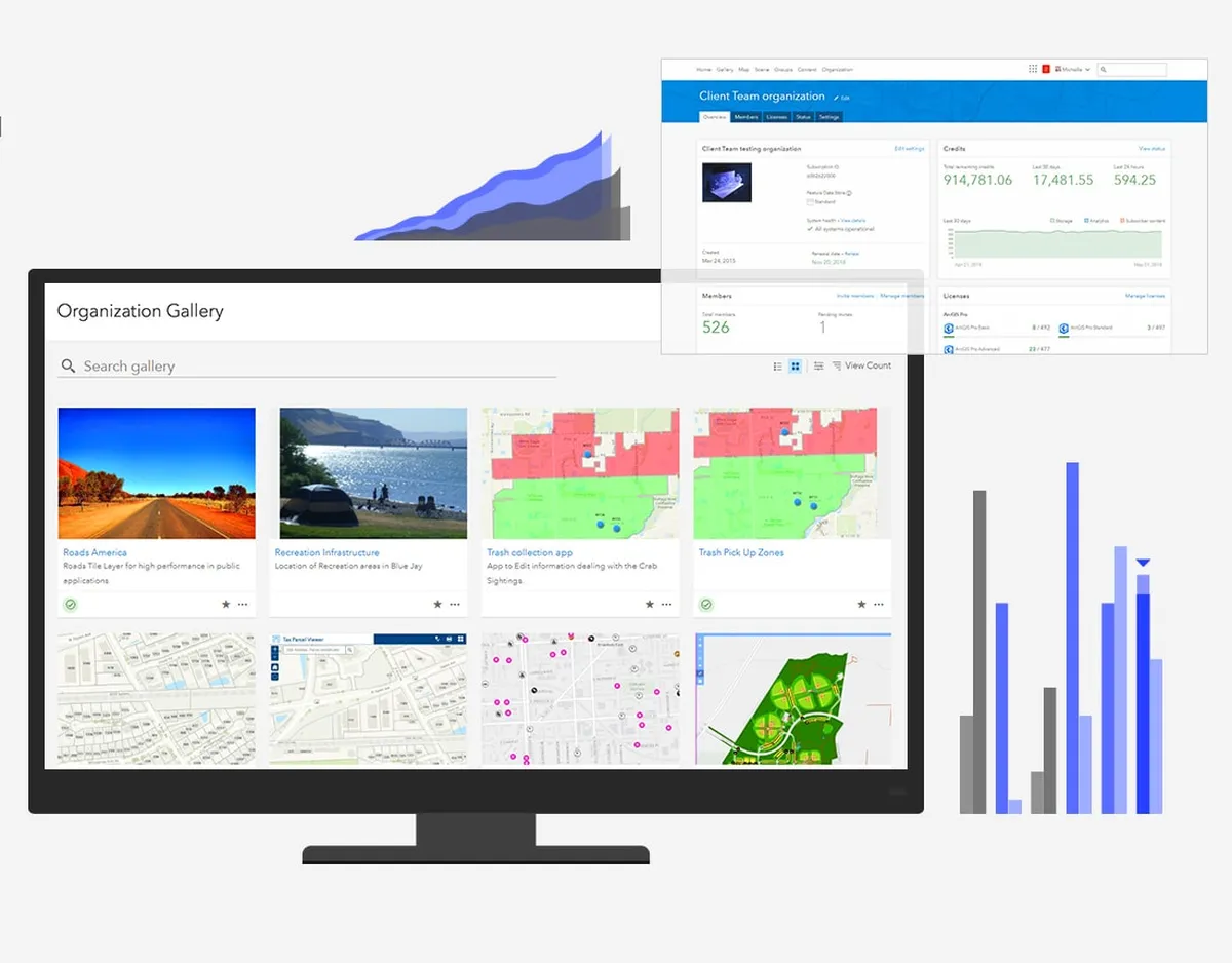
ArcGIS Features & Overview

ArcGIS Screenshot
ArcGIS Screenshot
Videos
Video #1

ArcGIS Reviews
Here is our opinion on ArcGIS : this is an excellent geographic information system (gis) tool to recommend .
ArcGIS User Reviews & Ratings
Online and customer reviews of ArcGIS software are quite plentiful and overall very positive :
Overall rating : 4,8
Value for money : 4,85
Functionality : 4,75
Usefulness : 3,9/5
Ease of use : 4,8
User rating Excellent : 10%
User rating Very Good : 90%
User rating Average : 0%
User rating Poor : 0%
User rating Terrible : 0%
The main advantages of ArcGIS are simplified data visualization, flexible use, and improved business decision making.
Popularity on social networks :
Your Customer Review on ArcGIS
What is your opinion about this app ? Submit your review and tell us about your overall opinion : experience with this SaaS software, rating, ease of use, customer service, value for money, Pros & Cons …
Customer reviews and feedbacks play an increasingly important role in the business software buying process. You can provide in-depth review and share your buying advice / reviewer sentiment : what is your likelihood to recommend ArcGIS ? What is your likelihood to renew ?
FAQs
Why use a Geographic Information System (GIS) tool ?
Geographic information software (GIS) is a platform for managing and tracking information and assets distributed over a geographic area. Due to its versatility, a GIS is used by several types of organizations. The system is most useful when used collaboratively so multiple people can add and edit specific asset and location details. Geographic information software (Geographic Information System: GIS) collects, stores, analyzes and disseminates information.
According to various sources, most used business software are : ArcGIS (market share : 39,70%), ESRI (34,00%), Mapinfo (8,90%), Arc-View (6,40%), QGIS (3,60%), Arc-Info (2,70%), Blue Marble Global Mapper (1,90%), ArcIMS (1,60%), Geocortex (0,70%), FME (0,60%), Geosoft (0,40%)
Main functions are : Web mapping, Data visualization, Asset Management, Work order management, Routing, Analysis and reporting
Main characteristics are : Cannibalization, Available premises, Catchment areas, Area search, Customer Knowledge, Event alert, Sales forecasting, Territory management, Customer flow, Sig, Optimization, Mapping, Itinerary, Planning, Geomarketing, Geolocation, Geocoding, Isochrone, Chalandise, Cloud, Geoptimization Optimization of activities by intelligent integration of geographical information in systems, Sig, Optimization, Mapping, Itinerary, Geomarketing, Geolocation, Geocoding, Isochrone, Chalandise
We have identified more than 83 competitors on the market.

Geographic Information System (GIS) Review
Company details
Developed by ESRI, Inc. (@Esri on Twitter)
HQ location : USA
Founded :
Total revenue :
Industry : B2B SaaS company
Software Category : Development Tools > Development & API > Geographic Information System (GIS)
Schema : SoftwareApplication > DeveloperApplication
Tags : free storage | gis | geographical | Maps | Mapping | cartography …
Website : visit esri.com
About This Article
This page was composed and published by SaaS-Alternatives.
The information (and product details) outlined above is provided for informational purposes only. Please Check the vendor’s website for more detailed information.
Our opinion on ArcGIS is independent in order to highlight the strengths and weaknesses of this Geographic Information System (GIS) tool. Our website is supported by our users. We sometimes earn affiliate commission when you click through the affiliate links on our website.
ArcGIS Alternatives
If you’re understanding the drawbacks and you’re looking for a ArcGIS alternative, there are more than 36 competitors listed on SaaS-Alternatives !
If you’re in the market for a new software solution, the best approach is to narrow down your selection and then begin a free trial or request a demo.
Top 10 Alternatives & Competitors to ArcGIS
– UpKeep
– Asset Essentials
– Wowflow
– Cartegraph
– Elements XS
– Arcgis Enterprise
– Mapinfo
– Fme
– Geoconcept
– Topplace
SaaS alternatives
Google Maps : Create rich applications and stunning visualizations of your data, leveraging the completeness, accuracy, and ease of use of Google Maps and a modern web platform that scales as you grow.
Tableau : Tableau can help anyone see and understand their data. Connect to almost any database, drag and drop to create visualizations, and share with one click.
Mapbox : We enable pinning travel locations on Pinterest, finding restaurants on Foursquare, and visualizing data on GitHub.
Power BI : Its goal is to provide interactive visualizations and business intelligence capabilities with an interface simple enough for end users to create their own reports and dashboards.
Leaflet : Leaflet is an open source JavaScript library for mobile-friendly interactive maps. It is developed by Vladimir Agafonkin of MapBox with a team of dedicated contributors. Weighing in at around 30KB of gzipped JS code, it has all the features most developers need for online maps.
You can also take a look at other business apps, like our Nitro review and our RMS Cloud review.
Comparison with Similar Software & Contenders
Take an in-depth look at popular Development Tools and Development & API to find out which one is right for your needs. Discover how these Geographic Information System (GIS) compare to ArcGIS when it comes to features, ease of use, customer support and user reviews. Explore software, Compare options and alternatives, Read reviews and Find your solution !


